math problem
#1

 Posted 16 March 2011 - 08:08 PM


#2

 Posted 16 March 2011 - 10:10 PM

If I did this correctly the the answer should be approx. 8º
Here's how I got that (I'm not that good at math so don't behead me if I'm wrong)

#3

 Posted 17 March 2011 - 06:53 AM

#4

 Posted 17 March 2011 - 07:20 AM

#5

 Posted 17 March 2011 - 09:52 AM

aren't all the internal angles of a triangle suppose to equal 180 degrees?
Yes. In this case it would be 8º+ 82º+ 90º = 180º
#6

 Posted 17 March 2011 - 11:39 AM

Actually, I've had some time to think about it and am wondering if the 120.42 is actually the hypotenuse. Since I'm being tracked by satellites I don't think the software would be able to calculate the horizontal distance as opposed to the actually distance walked down the hill. Would that make a difference?
Edited by Professional Customer, 17 March 2011 - 02:55 PM.
#7

 Posted 23 April 2011 - 06:37 PM

#8

 Posted 24 April 2011 - 05:44 AM

It is a hair over 8°:

#9

 Posted 24 April 2011 - 12:40 PM

#10

 Posted 25 April 2011 - 11:14 AM

#11

 Posted 25 April 2011 - 05:12 PM

Almost 7°:

#12

 Posted 10 June 2015 - 07:37 AM

After countless web searches I finally found the answer using the two websites below. The incline is 60.049 degrees.
http://www.csgnetwor...egradecalc.html
http://www.1728.org/gradient.htm
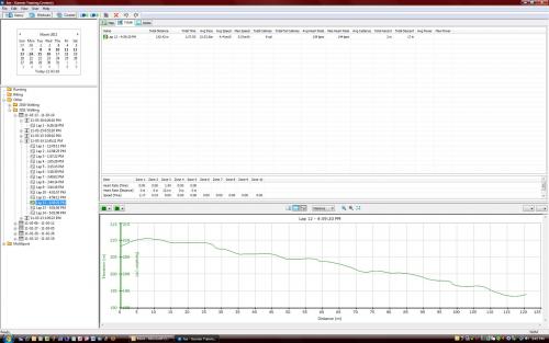
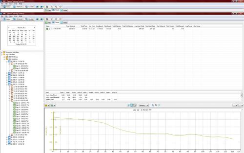
The problem others have had with answering this question is that using a protractor on the image I uploaded doesn't work. The image is not a cross-section of the hill it's a graph, and if you resize it you will constantly get different 'protractor' measurements.
And, YES, if you saw the hill or had to walk up that hill you would know it's far more steeper than 7-8 degrees suggested.
#13

 Posted 10 June 2015 - 10:40 AM

Okay, so let's draw it. The graph in your original message above supplies both the length and the height of your climb.
Length - The lowest point at the beginning of your climb is roughly at the 117 meter mark and the highest point at 7 meters. 117 meters minus 7 equals a total of 100 meters between the lowest and highest points.
Height - The lowest point at the beginning of your climb begins at a height of roughly 193 meters and the topmost point of 211 meters. 211 minus 193 equals a total height of 18 meters.
So, we have 100 meters long by 18 meters tall. Let's get it on paper:
- Lay a sheet of graph paper in front of you horizontally (landscape), and beginning at the bottom left corner, start counting the squares one by one off to the right until you reach 100 squares, and put a dot there at the bottom edge of the paper.
- Back at the bottom left corner of the graph paper, start counting the squares up the left edge one by one until you get to 18 squares, and put a dot there at the left edge of the paper.
- Take a ruler and draw a straight red line from that left dot you just made down to the rightmost dot. That is the angle of the hill.

- Now take a protractor and place it's center on the rightmost dot you made, making sure that the bottom edge of the protractor is aligned with the bottom edge of the paper. Now look at the degree markings along the left arc of the protractor and what is the angle of the red line?

I see close to 15-1/4 degrees.
Similar Topics
1 user(s) are reading this topic
0 members, 1 guests, 0 anonymous users
As Featured On:


 Sign In
 Create Account

